Japan’s recent announcement of discovering rare earth minerals sufficient for 780 years of global supply was not so much a surprise, but rather the practical culmination of 13 years of research efforts.
These efforts began in 2013 in the western Pacific Ocean near Japan’s Minamitorishima Island. From that date until 2018, scientists successfully created the first scientific map of this mineral treasure, using deep-sea drilling, precise chemical analysis, and geographic information systems.
Japan returned to the same site in 2026 using the research vessel “Chikyu”, operated by the Japan Agency for Marine-Earth Science and Technology, to confirm that what scientists had documented on paper was now practically feasible in reality.
The research expedition confirmed that what scientists had documented on paper was now practically feasible in reality.
The Beginning of the Discovery
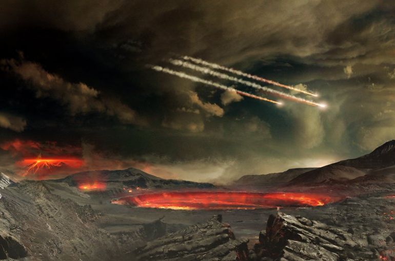
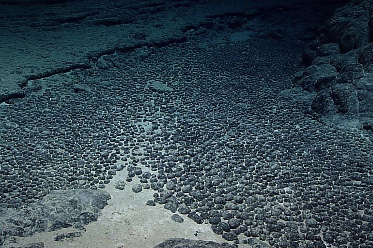
The dawn of the discovery broke in 2013, when researchers aboard the research vessel “Kairei” set out for the northwestern Pacific Ocean near Japan’s Minamitorishima Island. They carried analytical tools searching for tiny chemical traces within sea mud that, at first glance, appeared ordinary and worthless.
During that expedition, it was discovered that this mud was rich in the mineral “yttrium” and other rare elements at a rate exceeding 5,000 parts per million (meaning every million parts of mud contained over 5,000 parts of these rare minerals). This is a high concentration for rare earth elements, making it highly valuable for industrial use.
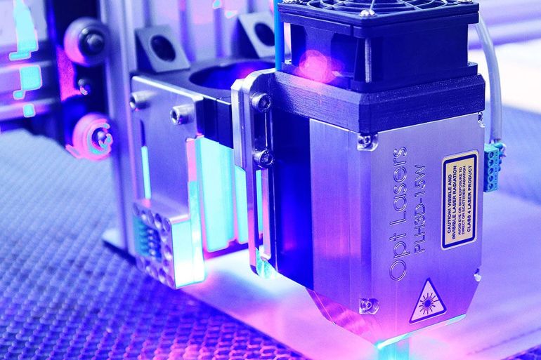
This important discovery was achieved through research activity that began by taking samples from the seabed using advanced drilling equipment to extract core samples of mud from the sediments. Then came the role of precise chemical analysis, using two instruments: inductively coupled plasma mass spectrometry and quadrupole mass spectrometry. These revealed the presence of enormous quantities of yttrium and other rare elements hidden within this dark mud.
Inductively coupled plasma mass spectrometry works like a “super-powered magnifier” for measuring metals. First, the sample is dissolved and converted into a fine liquid, which is then sprayed into a fiery plasma ignited at temperatures reaching 10,000 degrees Celsius.
At this immense heat, all chemical elements turn into charged ions. These ions then enter the quadrupole mass spectrometer, a device for analyzing ions and separating them based on their mass and electrical charge. This allows for the identification of chemical elements and compounds present in the sample and the measurement of their concentration with high precision.
In this way, scientists were able to distinguish each element from another, even if present in minute quantities, and calculate the concentration of each mineral with astonishing accuracy.
Expanding the Research
However, knowing “what the samples contained” was not enough. They needed to know which mineral
Japan
Japan is an island nation in East Asia with a rich cultural heritage spanning thousands of years, from its ancient Shinto traditions and imperial rule to the feudal era of samurai and the modernizing Meiji Restoration. It is renowned for its unique blend of deep tradition and cutting-edge technology, seen in sites like historic temples, castles, and serene gardens alongside bustling modern cities.
Shimizu port
Shimizu Port is a major seaport located in Shizuoka Prefecture, Japan, historically serving as a vital hub for maritime trade since the Edo period. It is famously known for its stunning views of Mount Fuji and has developed into a key port for both cargo and international cruise ships.
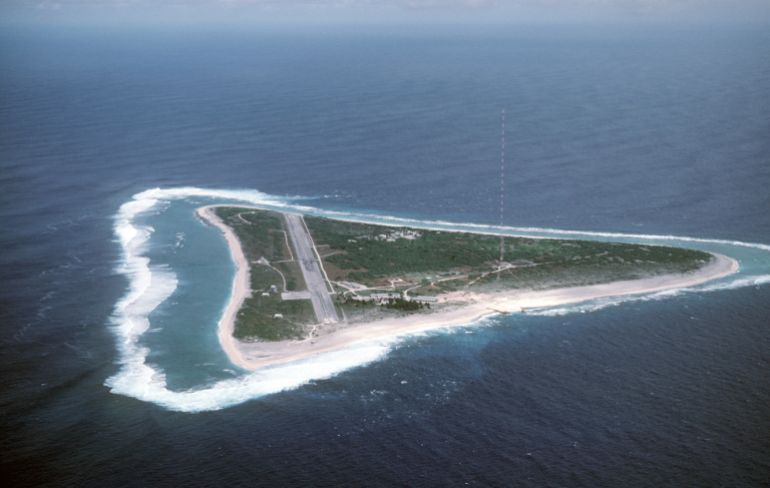
Minamitori Island
Minamitori Island, also known as Marcus Island, is a remote Japanese coral atoll located in the northwestern Pacific Ocean. It was claimed by Japan in the late 19th century and was the site of a significant World War II battle. Today, it hosts a meteorological station and is administered as part of Tokyo.
Shimizu
Shimizu is a port city in Shizuoka Prefecture, Japan, historically significant as a major harbor for the Tokugawa shogunate and a key point for maritime trade. Today, it is part of the city of Shizuoka and remains a vital port, famous for its views of Mount Fuji and as a gateway to the Miho no Matsubara pine grove.
Shizuoka prefecture
Shizuoka Prefecture is a region on Japan’s Pacific coast, historically significant as the final domain of Tokugawa Ieyasu, the founder of the Tokugawa shogunate. It is most famous for its postcard views of Mount Fuji, its deep green tea production, and its historical connections to the samurai era.
Minamitorishima Island
Minamitorishima Island is Japan’s easternmost territory, an isolated coral atoll in the northwestern Pacific Ocean. It was claimed by Japan in the late 19th century and is now significant for its surrounding exclusive economic zone and a station monitoring meteorological and ionospheric data.
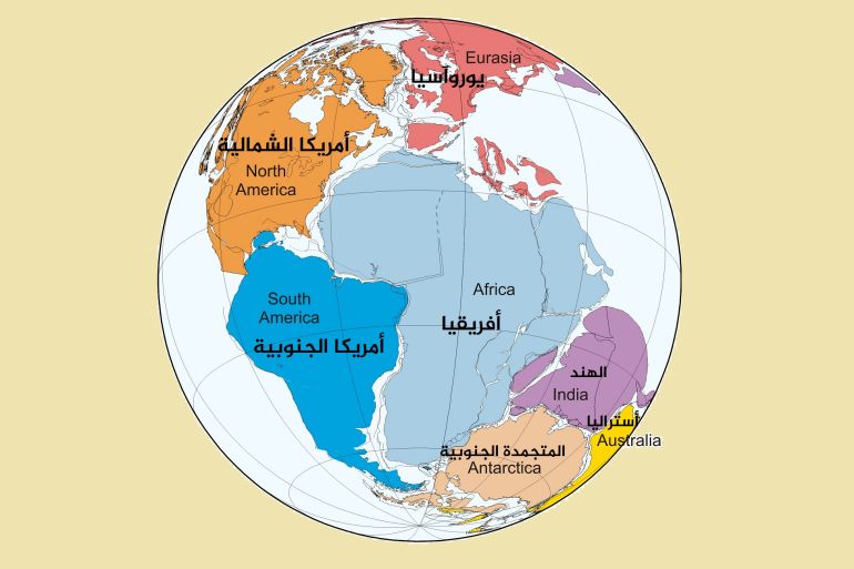
western Pacific Ocean
The Western Pacific Ocean is a vast marine region encompassing numerous island nations, archipelagos, and deep-sea trenches. Its history is deeply tied to ancient Austronesian migrations, European colonial exploration and trade from the 16th century onward, and pivotal World War II naval battles. Today, it remains a crucial area for global shipping, geopolitics, and diverse maritime cultures.
Japan Agency for Marine-Earth Science and Technology
The Japan Agency for Marine-Earth Science and Technology (JAMSTEC) is a Japanese national research institute established in 1971, originally as the Japan Marine Science and Technology Center. It conducts comprehensive research on the oceans, Earth, and atmosphere, operating advanced research vessels and submersibles to explore deep-sea environments and understand global climate systems.
northwestern Pacific Ocean
The northwestern Pacific Ocean is a vast marine region bordered by East Asia and Southeast Asia, historically significant as a major corridor for trade, migration, and naval conflict. It encompasses several key seas, including the East China Sea and the Sea of Japan, areas that have been central to regional dynamics for centuries.
Minamitori Island
Minamitori Island, also known as Marcus Island, is a remote Japanese coral atoll located in the northwestern Pacific Ocean. It was claimed by Japan in the late 19th century and was the site of a significant World War II battle. Today, it hosts a meteorological station and is recognized for its strategic importance and unique ecosystem.
Minami-Torishima
Minami-Torishima, also known as Marcus Island, is a remote, isolated Japanese coral atoll in the northwestern Pacific Ocean. It was first charted by the Spanish in the 16th century but was formally claimed by Japan in 1898, becoming its easternmost territory. The island has historically been significant for its guano deposits and now hosts a meteorological station and a small Japan Self-Defense Forces outpost.
Japanese archipelago
The Japanese archipelago is a chain of over 6,800 islands in East Asia, with its four main islands being Honshu, Hokkaido, Kyushu, and Shikoku. Its history is marked by the early Jomon culture, the rise of the imperial system, and periods of isolation and rapid modernization, shaping a unique cultural identity. The archipelago’s geography has profoundly influenced Japan’s development, from its feudal eras to its current status as a modern nation.
US Coast Guard station
The United States Coast Guard station network, established in 1790 with the founding of the Revenue Cutter Service, comprises shore facilities that support maritime safety, security, and environmental protection missions. These stations serve as operational bases for search and rescue, law enforcement, and homeland security activities along the nation’s coasts and waterways.

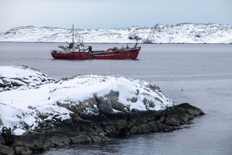
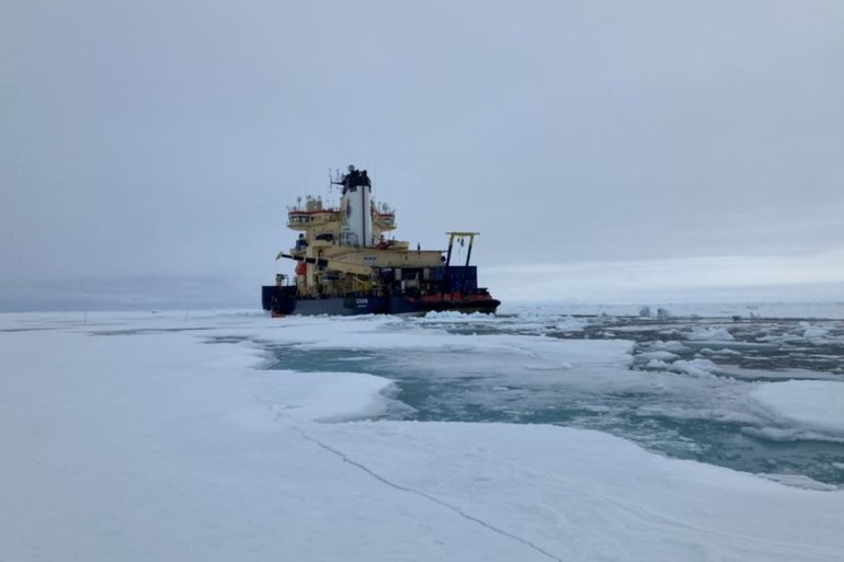
![[1/4] Japan's drilling-equipped research vessel Chikyu departs from Shimizu port to conduct a test recovery of rare-earth–rich mud near Minamitori Island, marking the world’s first attempt to continuously lift rare-earth seabed sludge from a depth of about 6 km onto a ship, in Shimizu, Shizuoka prefecture, Japan January 12, 2026.](https://www.aljazeera.net/wp-content/uploads/2026/02/1-2-1770150937.avif?resize=770%2C513&quality=80)
![[1/4] Japan's drilling-equipped research vessel Chikyu departs from Shimizu port to conduct a test recovery of rare-earth–rich mud near Minamitori Island, marking the world’s first attempt to continuously lift rare-earth seabed sludge from a depth of about 6 km onto a ship, in Shimizu, Shizuoka prefecture, Japan January 12, 2026.](https://www.aljazeera.net/wp-content/uploads/2026/02/1-1-1770150942.avif?w=770&quality=80)